← Home · Slopes & Walls

Slope Stability Analysis in Saguenay: Terrain Risks and Mitigation

Together, we solve the challenges of tomorrow.

SEE MORE →

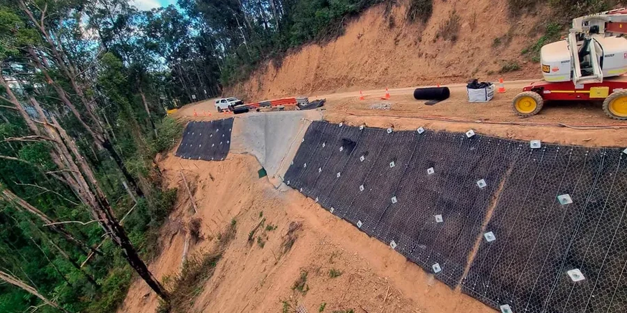
A contractor broke ground on a commercial development along Boulevard Talbot only to discover the cut slope was riddled with laminated silts. Within days of excavation, tension cracks appeared at the crest. Saguenay's topography, carved by glacial retreat into the Saguenay Graben, leaves steep valley walls mantled with sensitive marine clays that lose strength rapidly when disturbed. A detailed slope stability analysis is the only way to quantify that risk before earthworks begin. The analysis models drained and undrained conditions, integrating pore pressure data from the Laflamme Sea deposits that underlie much of the Jonquière and Chicoutimi boroughs. For projects near the Rivière Saguenay or its tributaries, we often pair the stability model with in-situ permeability testing to define groundwater flow nets that control seepage forces within the slope.

In Saguenay's sensitive clays, a factor of safety of 1.0 today can drop below 0.9 within hours of a rainfall event if the slope was designed with undrained peak strength instead of post-peak softened parameters.

Scope of work

In Saguenay's La Baie sector, the marine clay crust is often desiccated and fissured to depths of three to four metres, which creates a perched water table that local builders rarely anticipate. This upper zone behaves as a separate hydrogeological unit from the intact clay below. Our technical team runs limit-equilibrium models using Spencer and Morgenstern-Price methods to capture interslice forces accurately, then calibrates those models with laboratory triaxial data. Determining the effective friction angle and cohesion intercept from undisturbed Shelby tube samples is critical; we typically run consolidated-undrained triaxial tests with pore pressure measurement to define the stress path. For slopes exceeding eight metres, a staged construction analysis becomes necessary, and we incorporate excavation monitoring data from inclinometers and piezometers to validate the design assumptions during cut progression.
Slope Stability Analysis in Saguenay: Terrain Risks and Mitigation
Technical reference image — Saguenay

Area-specific notes

The risk profile in the Jonquière flats differs sharply from the steep slopes of Chicoutimi-Nord. Jonquière sits on thick, compressible clay where rotational failures can retrogress hundreds of metres inland—the Saint-Jean-Vianney landslide of 1971 remains a stark reminder of what sensitive clays can do. Chicoutimi-Nord, by contrast, deals with shallow translational slides at the till-bedrock contact, often triggered by spring snowmelt infiltration. A project on rue Roussel faces different failure mechanisms than one on boulevard Saguenay, even though they are only fifteen kilometres apart. Understanding which mechanism controls the site is the first step in any stability analysis. The second is selecting the right shear strength envelope: peak, fully softened, or residual. Getting this wrong in Saguenay's post-glacial sediments can mean the difference between a stable slope and a catastrophic flow slide.

Need a geotechnical assessment?

Reply within 24h.

Email: contact@geotechnicalengineering.co

Reference parameters


ParameterTypical value
Analysis MethodsLimit Equilibrium (Spencer, Morgenstern-Price, Bishop); FEM strength reduction where needed
Soil Units ModeledSaguenay marine clay (Laflamme Sea), Champlain Sea silt, glacial till, fluvial sand lenses
Key Input ParametersUndrained shear strength (Su), phi' and c' from CIU triaxial, residual friction angle, pore pressure ratio (ru)
Groundwater ModelingSteady-state and transient seepage; perched water tables in fissured crust
Target Factor of Safety1.5 for long-term drained conditions; 1.3 temporary works per NBCC
Failure Modes EvaluatedRotational slip, compound wedge, translational block slide along till-clay interface
Seismic AnalysisPseudo-static with kh from NBCC Saguenay seismic hazard (peak ground acceleration 0.2-0.3g)
Reporting StandardGeotechnical report with cross-sections, input parameters, sensitivity analysis, and remediation recommendations

Linked services

01

Desktop Study and Field Reconnaissance

Review of surficial geology maps, LiDAR DEMs, and historical air photos to identify prior landslide scars in the Saguenay valley. Site walkover to map seepage zones, tension cracks, and slope morphology.

02

Geotechnical Investigation for Slope Parameters

Sonic drilling and Shelby tube sampling to recover undisturbed specimens of sensitive clay. Downhole piezometers to measure artesian pressures common in the buried river channels beneath Saguenay's industrial parks.

03

Stability Modeling and Remediation Design

Limit-equilibrium and finite-element modeling for global stability. Design of mitigation measures including slope regrading, counterweight berms, deep drainage, or retaining structures where space constraints exist.

Standards used


NBCC 2020 (National Building Code of Canada) seismic provisions and geotechnical requirements, CSA A23.3-14 Design of Concrete Structures for retaining elements, CSA + ASTM D2850 / D4767 - Unconsolidated-Undrained and Consolidated-Undrained Triaxial Tests, ASTM D5084 - Flexible Wall Permeability for clay hydraulic conductivity, Canadian Foundation Engineering Manual (CFEM) 4th Edition for slope stability procedures

Quick answers

How much does a slope stability analysis typically cost for a project in Saguenay?

For sites in Saguenay, budget between CA$1,660 and CA$6,250 depending on slope height, geological complexity, and whether undisturbed sampling and triaxial testing are required. A small residential cut slope analysis falls at the lower end; a commercial development on sensitive clay with instrumentation and FEM modeling reaches the upper range.

What makes Saguenay's soils particularly challenging for slope stability?

The Laflamme Sea marine clays found throughout Saguenay are sensitive, meaning their undisturbed strength can be five to ten times higher than their remolded strength. When a slope fails, the clay liquefies and flows as a viscous liquid rather than sliding as a block. This retrogressive failure mode can propagate far beyond the initial disturbance zone, which is why even small excavations require careful stability assessment.

How long does a slope stability analysis take from start to finish?

A standard analysis for a building permit in Saguenay typically takes three to four weeks from field investigation to final report. That timeline includes drilling, laboratory triaxial testing (which requires about ten days for CIU tests with pore pressure measurement), modeling iterations, and preparation of stamped engineering drawings. Expedited schedules are possible for smaller projects if the site stratigraphy is already well-documented from adjacent work.

Location and service area

We serve projects across Saguenay and surrounding areas.

View larger map